🥝Geo-Spatial Analysis
Building a holistic understanding of your wider ecosystem through spatial data
What is it about and why is it relevant ?
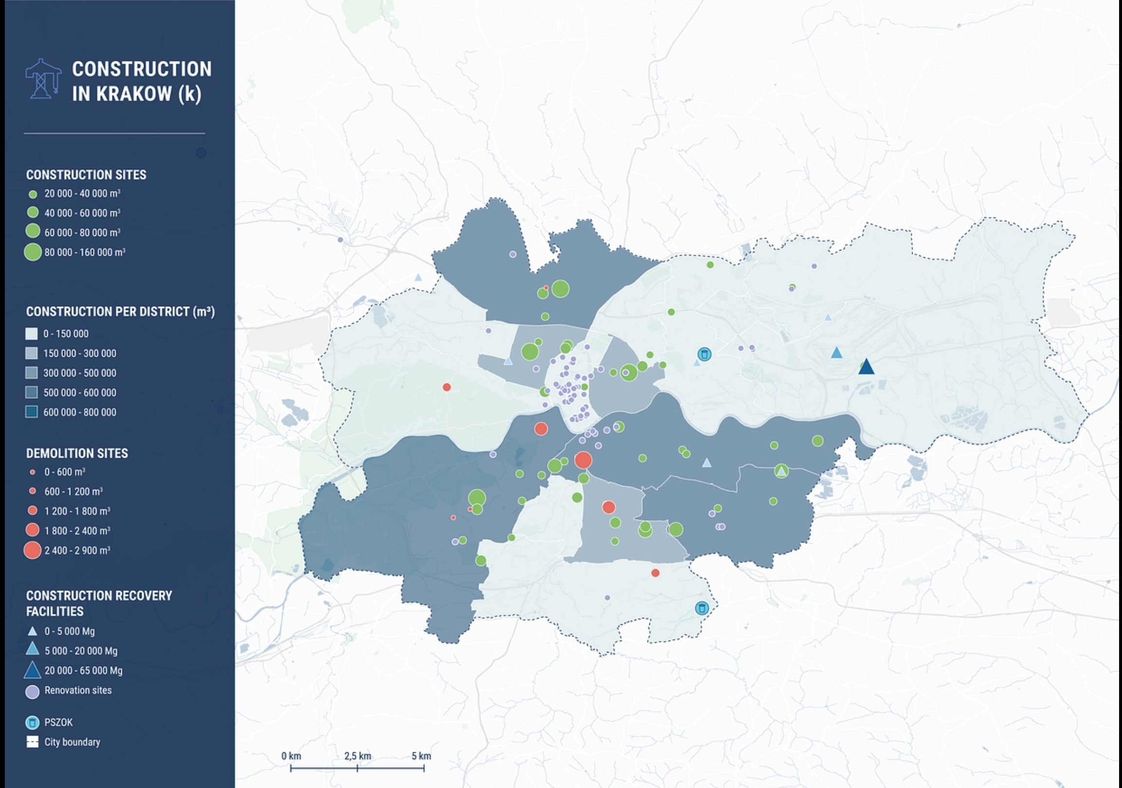
Geospatial Context Analyses are a way to build a holistic understanding of how a site, street or district is embedded in their wider urban ecosystem. Understanding cities as complex and interrelated systems, the geospatial context analysis helps to identify local challenges, as well as local assets. This method makes use of publicly available spatial data on population statistics, geodemographics, land uses, green space distribution, and other relevant geospatial parameters for pilot cities to build intelligence on how regeneration sites relate to their surroundings.
Metabolic, a CENTRINNO project partner, has implemented this tool in many different context. You can access here the reports of the Circular Cities Program in Poland, in which several Geospatial Context Analyses were developed to gather data and insights of different aspects of Krakow, Gdansk, and Lublin. In the link below you may also see an example for the case of Amsterdam:
This tool can be adapted to map resources or heritage items throughout the wider urban ecosystem, therefore it may have connections both with the Cartography and the Living Archive. To read more about the potential roles of Geo-Spatial Analysis in CENTRINNO, have a look at the Urban Ecosystem Mapping Guidebook (p.31)👍
Last updated