🥝Neighbourhood Typologies
Mapping how neighborhoods can contribute to city-wide goals
What is it about and why is it relevant ?
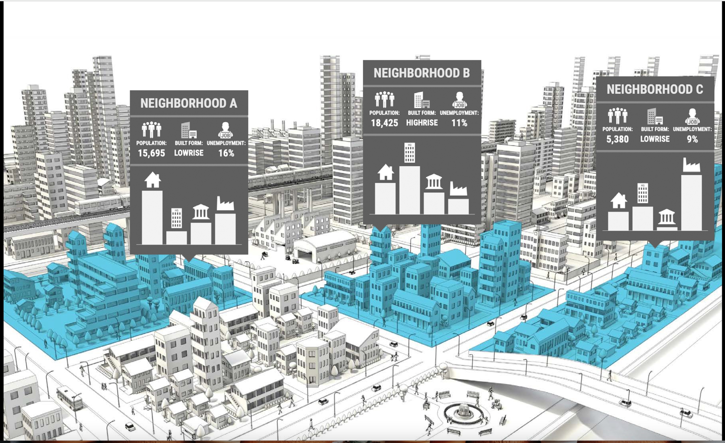
Neighbourhood typologies can help to identify the role that different neighborhoods can play in the transition to a circular economy at the level of the city. Not all neighborhoods can contribute to city-wide goals to the same extent. For example, a densely populated city-center will have less space available for generating renewable energy, but can play a larger role in reusing materials locally or exchanging products locally. Neighbourhood Typologies aggregate various geospatial data layers to generate descriptive "neighbourhood personas", allowing us to make sense of complex geospatial and demographic conditions of different neighbourhoods.
This type of categorization needs to be discussed among different stakeholders and may also support or influence the co-definition of the pilot city's focus. This sort of discussions, or sharing the results after the categorization, could be a sensitive process, for it may affect or clash with how communities self-perceive themselves. This method requires an open mind and an inclusive approach.
Pilots can use the neighbourhood typologies to syntethsize and make sense of the geospatial context analysis they have previously done. This is a key element of the cartography and it may include heritage-related or socio-economic content in the CENTRINNO Cartography. To read more about the potential roles of Neighbourhood Typologies in CENTRINNO, have a look at the Urban Ecosystem Mapping Guidebook (Annex 1):
Summary Table
Characteristics | |
Purpose | Identify the role of neighbourhoods in a city |
Difficulty | Medium |
Duration | n.a. |
Facilitator | Participants | n.a. |
Setting | Online & Offline |
Contact | |
CENTRINNO Tagging System | |
Other Tags | SMEs, community, neighbourhood, city |
Last updated